Tokyo: the district guide that makes the city legible
Yamanote and Shitamachi, special wards, terminal stations: how Tokyo is organised, what each district is for, and why the streets have no names.
La rédaction Kotoba Interactive
Studio éditorial
Tokyo is not a city. Administratively it is a prefecture, , and its core consists of twenty-three which have been full local authorities since 1947, each with an elected mayor, an assembly and a budget. Shibuya is not a neighbourhood of Tokyo the way Montmartre is a neighbourhood of Paris: it is a municipality of some two hundred and thirty thousand people that happens to form, with twenty-two others, what the world calls Tokyo.
That absence of a single centre explains nearly everything else. The twenty-three wards hold roughly 9.8 million residents, the prefecture 14 million, and the Kantō urban area close to 37 million, the largest on earth. A conurbation of that size cannot be read through its streets, especially since most of them have no name. It is read through its stations.
A metropolis without street names#
A Japanese address does not describe an axis, it nests areas. You start with the ward (区, ku), move to the neighbourhood (町, chō or machi), then to the 丁目 (chōme), a numbered sub-district, then the 番 (ban), the block, then the 号 (gō), the building. Shibuya-ku, Jinnan 1-chōme, 19-11: no street appears anywhere. The system was generalised by the 1962 law on residential address indication, and block numbers follow the order in which the land registry assigned them rather than any progression along a road.
The practical consequence is that nobody in Tokyo finds an address by reading the address. You find it with a map, with the neighbourhood police box (交番, kōban) stationed outside every major station, or by doing what residents do: naming a station, an exit and a visible landmark.
The word 駅 (eki) means station, but its older sense is a post relay on an imperial highway. Tokyo's great stations inherited that function: they are places where you change railway company, eat, shop, and around which the city has densified in concentric rings.
Yamanote and Shitamachi: the dividing line#
Edo, the shogunal capital founded in 1603 by Tokugawa Ieyasu and renamed Tōkyō in 1868, was built on two kinds of ground. To the west, the Musashino plateau with its hills and valleys: this is the , the high city, where the residences of warriors and provincial lords were set. To the east, the alluvial plain reclaimed from the bay and cut through with canals: this is the , the low city, of merchants, craftsmen and theatres.
The distinction has not been administrative for a very long time, but it remains audible in the buildings, in the shops and in speech. A Tokyoite from Taitō or Sumida will readily claim Shitamachi as a temperament: blunt, loud, hospitable.
The loop of the , closed on itself in 1925, 34.5 kilometres long and some thirty stations strong, gives that geography a physical form. It does not serve the centre, it circles it, and the great urban poles have fastened themselves onto its stations.
The western terminals: Shinjuku, Shibuya, Ikebukuro#
These three wards share an origin: each grew from an interchange between the national railway and a private commuter company.
holds the first. Shinjuku station is recognised by Guinness as the busiest in the world, on the order of 3.5 million passengers a day, with more than two hundred surface exits. West of the tracks, Nishi-Shinjuku lines up the administrative towers, including the prefectural headquarters designed by Kenzō Tange and completed in 1991, with two free observation decks. East of them, Kabukichō concentrates the nightlife, Shinjuku Ni-chōme is the densest gay district in Asia, and the Golden Gai packs roughly two hundred tiny bars into six lanes, a survival of a postwar black market. To the south, Shinjuku Gyoen, a former imperial estate opened to the public in 1949, supplies the green counterweight.
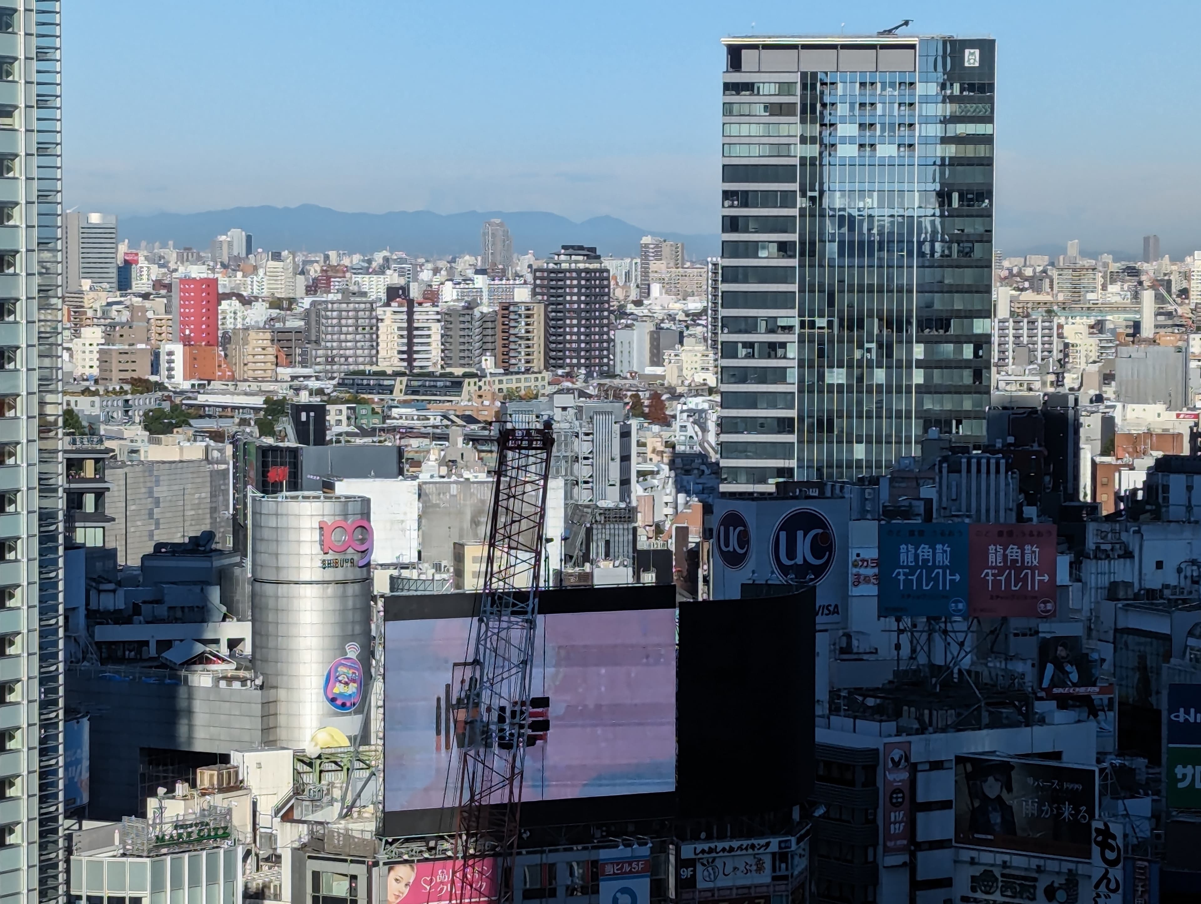
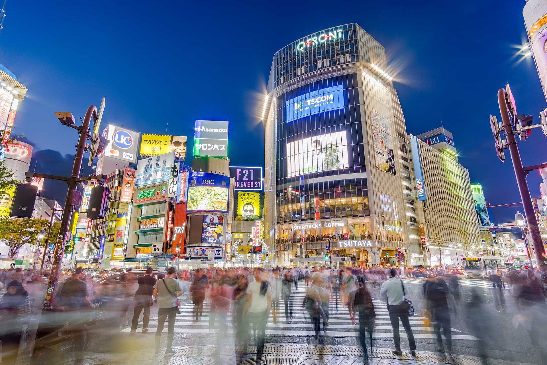
holds the second, and the global image. The diagonal crossing outside the station can release around three thousand people per green cycle. Around it the city stratifies: Center-gai for commercial adolescence, Dōgenzaka for live venues, Shibuya Scramble Square, a 230-metre tower delivered in 2019, for the rooftop view. The north of the ward changes scale entirely: Harajuku and Takeshita street for teenage fashion, Omotesandō and its run of commissioned architecture by Ando, SANAA or Herzog & de Meuron, Aoyama for quiet luxury, and Meiji Jingū, consecrated in 1920, whose 70-hectare forest was planted entirely by hand. Ebisu and Daikanyama, to the south, are the adult, settled face of the same ward.
holds the third with Ikebukuro, long treated as the poor relation of the trio and now the capital of otome culture. The Sunshine City complex, opened in 1978 around a 240-metre tower that was then the tallest in Asia, adjoins , a street of shops specialising in merchandise aimed at women.
The historic and business core: Chiyoda, Chūō, Minato#
occupies the central void. The Imperial Palace stands on the footprint of Edo Castle, whose moats, bridges and cyclopean walls remain; the East Gardens are open to the public. Around it sit single-purpose districts of striking clarity: Marunouchi for corporate headquarters and Tokyo station, whose 1914 brick façade was restored in 2012; Kasumigaseki for the ministries; Nagatachō for the Diet; Jinbōchō for books, with some hundred and thirty second-hand bookshops inherited from the university quarter; and Akihabara, in Sotokanda, which went from postwar radio market to electronics to otaku culture.
holds the old commerce. Nihonbashi carries the bridge, rebuilt in stone in 1911, which has served since 1604 as the zero point of the archipelago's five great highways; the distance marker is still set into the roadway. Ginza takes its name from the silver mint moved there in 1612, and its department stores, Mitsukoshi and Wakō, still structure the avenue. Tsukiji lost its wholesale market, transferred to Toyosu on 11 October 2018, but the outer market remains very much alive.
is the ward of embassies and towers. Tokyo Tower, completed in 1958 at 333 metres, still anchors the southern skyline. Roppongi combines international nightlife with museums, with Roppongi Hills delivered in 2003 and the Mori Art Museum. Azabudai Hills, opened in 2023, holds the tallest building in Japan at roughly 325 metres. Odaiba, on reclaimed land in the bay, completes the set with its malls and its view of the Rainbow Bridge.
The eastern city: Taitō, Sumida, Kōtō#
is the heart of Shitamachi. Asakusa organises itself around Sensō-ji, which tradition dates to 628 and which remains the oldest temple in the city, approached through the Nakamise shopping lane. Ueno gathers the park, opened in 1873 among Japan's first public parks, the Tokyo National Museum founded in 1872, a zoo and the Ameyoko market laid out under the railway viaduct. Kappabashi, with some hundred and seventy catering supply shops, sells knives and resin food models alike. Yanaka, spared by the bombing, keeps a fabric of lanes, temples and prewar shops.
holds the left bank. The Tokyo Skytree, inaugurated on 22 May 2012 at 634 metres, is the tallest tower in the world. Ryōgoku is the sumo district: the Kokugikan hosts three of the six annual tournaments, in January, May and September, and the wrestling stables are scattered around it.
mixes eras. Toyosu houses the new wholesale market, Kiyosumi-Shirakawa became a roasting district after Blue Bottle opened its first Japanese address in a former warehouse there in February 2015, and Monzen-Nakachō keeps its temples and neighbourhood shops.
Where people actually live: Setagaya, Suginami, Nakano, Meguro#
is the most populous ward, with around 940,000 residents, and apparently the least touristic. Shimokitazawa concentrates theatres, live houses and vintage clothing; burying the Odakyū line freed a surface corridor redeveloped between 2019 and 2022. Sangenjaya and Yōga are ordinary residential districts, which is exactly their interest.
holds Kōenji, unofficial capital of second-hand clothing and independent rock, which has staged an Awa Odori festival since 1957 drawing close to a million spectators in August. holds Nakano Broadway, a shopping arcade opened in 1966 that has been Mandarake's collectors' territory since 1980.
offers the contrast of the riverbanks: Nakameguro lines some eight hundred cherry trees along a canalised river, Jiyūgaoka cultivates an urbanism of small shops. , finally, is the ward of study, with the University of Tokyo's Hongō campus and its red gate of 1827.
| District | Ward | What it is for | Access line |
|---|---|---|---|
| Asakusa | Taitō-ku | Sensō-ji, craft supplies, Shitamachi | Ginza, Asakusa |
| Ueno | Taitō-ku | Museums, park, Ameyoko market | Yamanote |
| Yanaka | Taitō-ku | Prewar lanes, temples | Yamanote (Nippori) |
| Ryōgoku | Sumida-ku | Sumo, Edo-Tokyo museum | Sōbu |
| Akihabara | Chiyoda-ku | Electronics, otaku culture | Yamanote |
| Jinbōchō | Chiyoda-ku | Second-hand bookshops | Hanzōmon |
| Ginza, Nihonbashi | Chūō-ku | Department stores, old commerce | Ginza |
| Roppongi | Minato-ku | Museums, nightlife | Hibiya, Ōedo |
| Shinjuku | Shinjuku-ku | Towers, Golden Gai, Kabukichō | Yamanote |
| Shibuya, Harajuku | Shibuya-ku | Fashion, the crossing, Meiji Jingū | Yamanote |
| Ebisu, Daikanyama | Shibuya-ku | Dining, bookshops, quiet | Yamanote |
| Ikebukuro | Toshima-ku | Otome Road, Sunshine City | Yamanote |
| Shimokitazawa | Setagaya-ku | Theatres, vintage clothing | Odakyū, Keiō Inokashira |
| Kōenji | Suginami-ku | Second-hand clothing, rock | Chūō |
| Nakameguro | Meguro-ku | Cherry trees, riverside shops | Hibiya, Tōkyū Tōyoko |
| Kiyosumi-Shirakawa | Kōtō-ku | Coffee roasters, museum | Hanzōmon |
Three words are enough to decode a Tokyo map: 駅 (eki, station), 出口 (deguchi, exit) and 丁目 (chōme, the numbered sub-district). JapaneseSRS, our spaced repetition app for learning Japanese, is coming soon: join the waiting list and start reading the signs instead of photographing them.
Getting around: what to understand once#
There are two subways, not one. The underground network is run by two separate companies, Tokyo Metro (nine lines) and Toei (four lines), with separate fares. Transferring between them costs more than an equivalent trip on a single network, unless a combined fare applies.
JR is not the subway. The Yamanote line and the Chūō, Sōbu and Keihin-Tōhoku lines belong to JR East. It is a third system, with its own gates, and often the fastest way to cross the city.
Private railways leave from the big stations. Odakyū and Keiō leave Shinjuku, Tōkyū leaves Shibuya, Seibu and Tōbu leave Ikebukuro, Keisei leaves Ueno for Narita. This is what explains the scale of those stations: they stitch the national network to the suburbs.
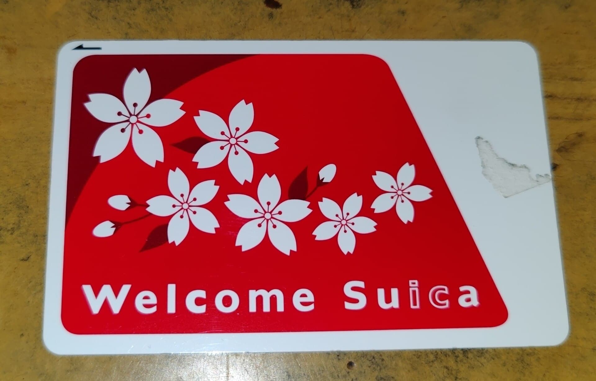
One card covers everything. Suica, launched in 2001, and PASMO, in 2007, are interoperable with each other and with most regional cards since 2013. They work on trains, buses, in convenience stores and in many vending machines.
Find the exit before you exit. In a station like Shinjuku or Shibuya, the wrong exit costs tens of minutes. Signs systematically list the surface landmarks each exit serves.
Tokyo streets that do carry a name almost always received it commercially or commemoratively, not administratively. Omotesandō literally means "the main approach avenue": it is the road laid out to lead to the Meiji shrine, and the luxury boutiques along it occupy, not always knowingly, a pilgrimage path.
Three days, three readings of the city#
The city of Edo. Asakusa in the morning before the crowds, up to Kappabashi, lunch at Ueno, an afternoon at the National Museum, the end of the day in the lanes of Yanaka, dinner in an izakaya near Nippori.
The western city. Meiji Jingū at opening, Harajuku and Omotesandō late morning, lunch in Aoyama, Shibuya mid-afternoon, up to Shibuya Sky at sunset, the evening in Shinjuku between Golden Gai and Ni-chōme.
The city of water. Kiyosumi-Shirakawa in the morning, across Kōtō, the Toyosu market, Odaiba in the early evening for the bay, back over the Rainbow Bridge.
Tokyo does not visit like a capital, with an axis and monuments lined up along it. It visits like an archipelago of towns held together by one railway network, each of which has kept its own hour.
Read alsoKonbini: why Japan's convenience stores are legendaryThe always-open convenience store is the basic service that makes a stay in any of these districts workable.
What happens in the evening in the lanes of Shinjuku and Nippori, table by table.
FAQ#
Where should I stay in Tokyo on a first visit? Anywhere on the Yamanote loop between Ueno, Tokyo and Shinagawa puts you within thirty minutes of most sites. Shinjuku and Shibuya suit people who go out at night, Asakusa and Ueno those who want Shitamachi and museums, Ginza those who prefer quiet and shopping.
How many days do you need for Tokyo? Four full days cover the historic east, the western terminals and one residential ward. A week adds Kōtō, Odaiba, a day trip to Kamakura or Nikkō, and time to wander without a plan.
Do you need Japanese to get around? No. Railway signage is bilingual and announcements are doubled in English at the main stations. Being able to read kana does change how you read menus and neighbourhood shopfronts, where English disappears quickly.
Why do the streets have no names? Because the Japanese addressing system numbers blocks rather than roads. It descends from the historic land registry and was standardised by the 1962 law. Major avenues do have names, but they are not used to compose an address.
Is a Japan Rail Pass worth it for Tokyo? Not for a stay confined to the capital: the national pass covers only JR lines, leaves out both subways, and pays for itself only with long-distance travel. A rechargeable Suica or PASMO is enough.
Photo credits: the images in this article come from Wikimedia Commons and are under a free license.
The apps you actually need to travel in Japan
Earthquake alerts, train times, Suica on your phone, translation, Tabelog: the apps that genuinely change a trip to Japan, and the ones that will not work for you.
Cover image: Benh LIEU SONG · Benh LIEU SONG, via Wikimedia Commons · CC BY-SA 2.0